Friday 27 April 2007

Short Stirling LJ628

We visited this RAF Stirling crash site on 26th April 2007. We found a group of good sized pieces of wreckage in a clough around 1/3 of a mile away from the main group of wreckage, and well away from any coordinates published elsewhere.
Short Stirling LJ628

This wreckage is at:

SK 20721 95701.


The former main group of wreckage was cleared, by the Stirling Project. There are however many fragments and small groups of wreckage left over near the commonly published coordinates, in particular on a line between SK 20336 95659 and


SK 20218 95590, where you can see this pile of wreckage.


More info

Saturday 14 April 2007

Gloster Meteors WA971 and VZ518

Gloster Meteors WA971 and VZ518 RAF:Cross
Meteor wreckage around informal memorial cross at:

SE 06872 02901


We visited this site on 12th April 2007, 57 years to the day after a mid-air collision between two RAF Meteors. There are huge chunks of wreckage easily visible all around these coordinates, which refer to the location of the informal memorial cross from which this picture was taken.
More information

Tuesday 10 April 2007

Avro Lancaster KB993

This is very close to the Dakota, it may have been hard to tell where one wreckage field ended, and the other began.
Avro Lancaster KB993:Memorial
Memorial local to Lancaster wreckage

SK 07931 94775


Below is what we assume is left of the Lanc, ten feet from the memorial. The Dakota wreckage field is however very close, and it has been suggested that this is part of the Dakota. We are looking into this, and also into which of the other wreckage we logged and photographed in the area is from the Lancaster if this isn't. We checked, and this is indeed the Lanc.
Avro Lancaster KB993:Wreckage


More info

Consolidated Liberator B-24J 42-52003

We revisited this one to get accurate coordinates, and a photo in sunshine, instead of hammering rain. This is an easy one to get to, path all the way from the layby by the Grouse pub.
Consolidated Liberator B-24J 42-52003


Liberator Wreckage:

SK 05755 90614


More information

Sunday 8 April 2007

Douglas C-47 Dakota 42-108982

Got to this one on the second attempt. The first attempt (in three feet of snow) is pictured on my first posting.
Douglas C-47 Dakota 42-108982:Wing

Dakota wing:

SK 08052 94734


Douglas C-47 Dakota 42-108982: Undercarriage


Dakota undercarriage:

SK 08144 94596


More info

North American Sabres F86 XD707 & XD 730

North American Sabres F86 XD707 & XD 730 RAF


RAF Sabre wreckage:

SK 07346 90257


More info

Discussion Group

Our discussion group is here. There is much more detailed information there. You are welcome to join.

Boeing B-17G-65 Fortress 43-37667

Boeing B-17G-65 Fortress 43-37667 USAAF


USAAF Flying Fortress wreckage:

Location: SE 07093 09535

WARNING-THIS IS IN A RIFLE RANGE

More info

Gloster Meteor RA487

Gloster Meteor RA487 RAF

RAF Meteor wreckage and accompanying crater:
SK 16573 89041


More info

Peak District Wreck Hunting

I'm Sean. Me and my friend Mick go out every week, looking for plane wrecks, mainly wartime, mainly on high ground in the Peak District and Snowdonia. This doesn't make us 'plane nuts though. It's about the walk mainly.

We do feel affection for most of the plane enthusiasts we come across, but let's face it, it's a sad sort of hobby, and some of them take themselves entirely too seriously.

There are quite a few sites on the 'net which cover this area, but you will find that the information on them is of very variable quality, and they may want to charge for accurate wreck co-ordinates, if they will let them have any at all. You will find, as we have, that the coordinates available free may be several miles away from the real sites.

Those who have visited quite a few wreck sites are often very precious about giving any information on location to people starting up in the hobby. Some of them even seem to believe that it would be economic to weigh the wrecks in for scrap, and that anyone enquiring as to locations might secretly be a patsy for a band of roaming scrap merchants. Amusingly, the only people weighing in planes for scrap are the very same people who accuse others of doing it.

Anyway, we don't see why anyone should waste time on searching for wrecks if they just want to go and look at them. We are going to publish a GPS validated 5 decimal place coordinate for the most notable piece of wreckage along with a description of what is there, and the local conditions. On a technical note, all coordinates use the OSGB datum.

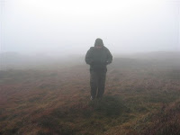
Walking in high country other than in summer can be on the challenging side. Even in summer, the weather can change rapidly for the worse. Some of these sites are on or near cliffs, sink holes, abandoned wells, and rifle ranges. Wandering about in some of these areas without the right kit and knowledge is dangerous, potentially even fatal. Navigation can become very difficult, especially if the visibility drops. Don't say we didn't warn you. Here's a couple of illustrative pics...
Peak District Plane Wreck Hunting


Peak District Aircraft Wreck Hunting

Take only photos, leave only footprints...

Thanks for the links to:

Skills-Bills - Quality Sweary Birding Action
Sheffield on the Internet - Portal and Information Source for Sheffield, South Yorkshire and the Peak District for business, tourists, visitors and expats.
Chase me... its a reciproll thing